Cart 0
Mapping Lab


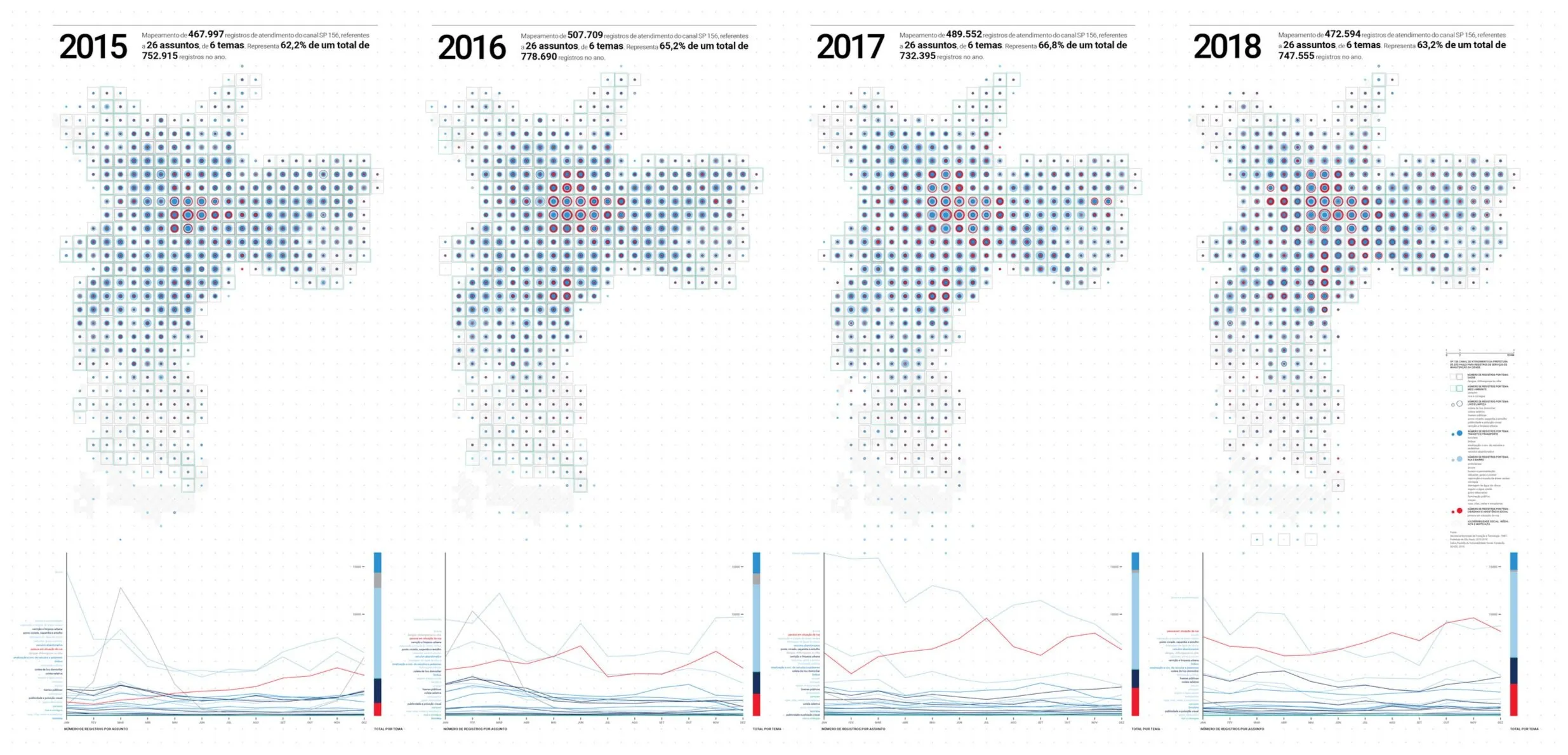
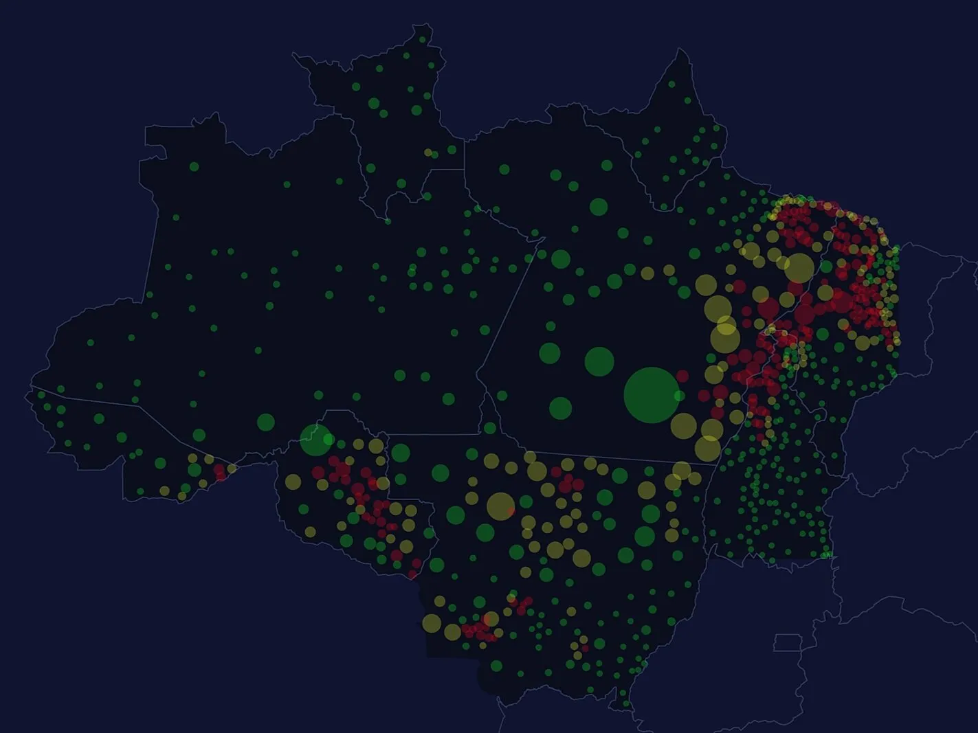
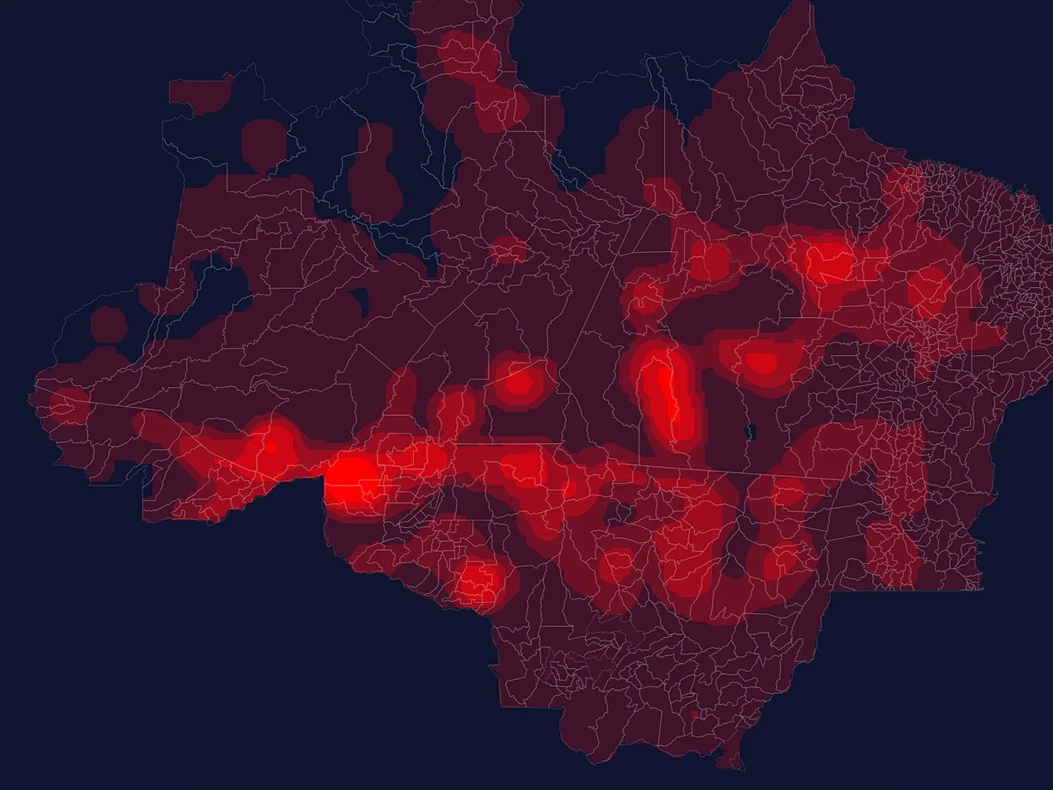
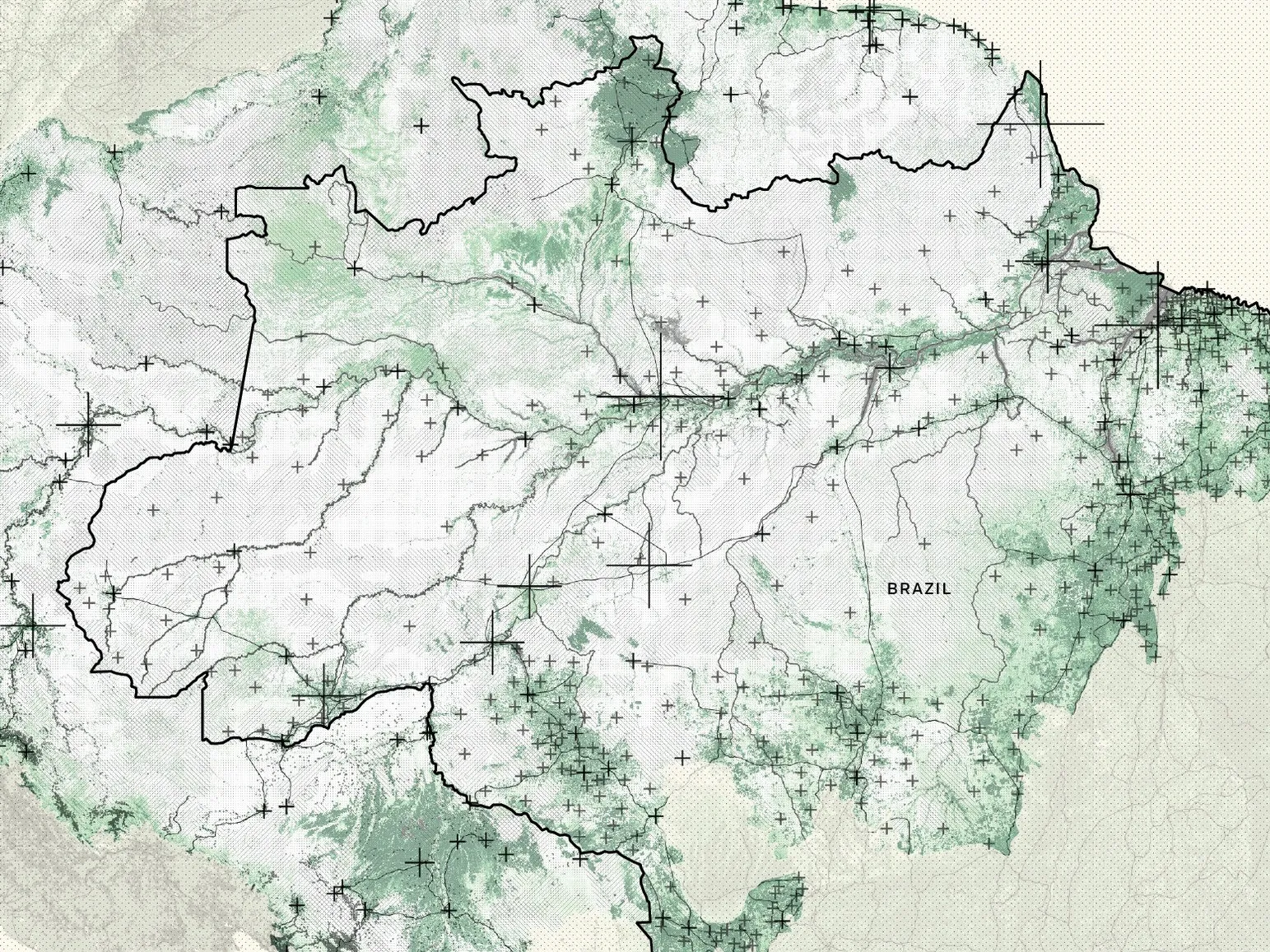
Urban data visualization lab

exploring the way we understand cities
through data


mapa_pixo5.png

OUR WORK

We design interactive experiences, data analysis, visualization, maps and cartography.

Cidadão 156 Data visualisation about urban maintenance of São Paulo city presented at the International Architecture Biennale of São Paulo 2019.

Cidadão 156
Data visualisation about urban maintenance of São Paulo city presented at the International Architecture Biennale of São Paulo 2019.

Amazon deforestation Interactive map about the Amazon deforestation until March/2018. Work developed for Volt Data Lab, a data-driven news agency.

Amazon deforestation
Interactive map about the Amazon deforestation until March/2018. Work developed for Volt Data Lab, a data-driven news agency.

Embargoed areas Interactive map about embargoed areas in Amazon region until March/2018. Work developed for Volt Data Lab, a data-driven news agency.

Embargoed areas
Interactive map about embargoed areas in Amazon region until March/2018. Work developed for Volt Data Lab, a data-driven news agency.

Case Studies: Mapping Urban Data A series of 10 maps with the theme "Walls of Air" designed for the Brazilian Pavilion Catalogue at the Venice Biennale 2018.

Case Studies: Mapping Urban Data
A series of 10 maps with the theme "Walls of Air" designed for the Brazilian Pavilion Catalogue at the Venice Biennale 2018.

Educational Landscape Density-dot map that represents the population aged 25 and over by their highest level of education in São Paulo and Rio de Janeiro, Brazil.

Educational Landscape
Density-dot map that represents the population aged 25 and over by their highest level of education in São Paulo and Rio de Janeiro, Brazil.

Tá tudo dominado Interactive map showing cases of criminal organizations between 2016 and 2017 in Rio de Janeiro, Brazil.

Tá tudo dominado
Interactive map showing cases of criminal organizations between 2016 and 2017 in Rio de Janeiro, Brazil.

The accessibility of social infrastructure Exploring and visualizing the distribution of social facilities in the city of São Paulo, Brazil.

The accessibility of social infrastructure
Exploring and visualizing the distribution of social facilities in the city of São Paulo, Brazil.


what we do


perfil.jpg

who we are

carolina passos

Graduated in Architecture and Urbanism from the University of São Paulo, Brazil, with postgraduate course in Geospatial and Environmental Analysis. She worked as an urban planner and designer at Vigliecca & Associados from 2012 to 2018, developing urban projects and strategic plans, such as the Urban Operation Mooca-Vila Carioca and Arco Tietê in São Paulo, Urban Plan of the Orla de Salvador, and the Masterplan of the Deodoro Olympic Park in Rio de Janeiro. Since 2018 she has been a consultant in the development of urban projects with offices such as Triptyque Architecture, Raddar and Natureza Urbana. She has also served as a consultant in Geospatial Data Analysis at the World Bank Group.

She is the founder and urban data expert of Mapping Lab, combining expertise in planning and design, GIS research and analysis to development of interdisciplinary projects, which has participated at the Biennale di Architettura di Venezia 2018, International Architecture Biennale of São Paulo 2019 and the 2019 Seoul Biennale of Architecture & Urbanism.


Contact

For additional information or any project you want our collaboration, please contact us at hello@mappinglab.me


Follow us